|
| Rain along the Arizona Strip near Colorado City |
 |
| Sunset on the Kaibab Plateau |
The Kaibab Plateau is better known as the place that makes the North Rim of the Grand Canyon possible. It is basically a high elevation alpine plateau ending at the grand canyon. I have long wanted to visit the North Rim, which is only open in the summer season. Finally, we made it last week-end.
We headed out about 9 AM on Saturday. 2 hours from Vegas to St. George, Utah, then turn south at Hurricane UT, through Colorado City AZ and across the western part of what's called the Arizona Strip to Fredonia AZ and south to the Kaibab Plateau to Jacob Lake and checking in at the very friendly
Jacob Lake Inn. We arrived at the Inn about 2 PM, mostly because we take stops for pictures and to just soak the scenery in. As we drove across the Arizona strip to Fredonia, there was a lot of thunderstorm activity that was just beautiful to watch. Of course catching a shot with lightning was elusive but I did get a few. Pictures can only whisper of these vast places. The smell of the desert sage in the rain, and the incredible immensity of the views. Then there are the multiple climate and ecosystems, the ever changing skies etc, etc. .....wow
After having lunch at the Jacob Lake Inn and checking into our room. We headed south down the plateau to the North Rim visitor center and Lodge. The entire drive is a view of beautiful alpine meadows, forests of ponderosa pines, spruce, aspens, the local herds of bison and grazing mule deer. Wildflowers were abundant in the meadows and the roadsides and the clouds made for constantly changing light. The road also takes you through large burned areas from the 2006 fire, which are filled with young aspen trees that seem to be aggressively taking over those areas from the pines.
 |
| Flowers at Jacob Lake Inn |
 |
| Kaibab Meadows |
After rising out of the high desert, it was wonderful to be surrounded by this alpine scenery being constantly refreshed by the summer monsoon rains. Once we arrived at the lodge and had been wowed by the view in the sun room, we did what most people do there. Found a seat on one of the two viewing terraces, put our feet up on the balustrade, sipped a drink and munched on sandwiches from the lodge deli. We relaxed while chatting with people from multiple states and countries. Then waited for the sunset to hit the canyon. The North Rim is not crowded, even during the short tourist season, and the lodge has a very intimate, relaxed and friendly atmosphere which envelopes everyone. Children played games in the sun room and a park ranger answered questions from small groups of people on the east terrace, while others soaked up the fading rays of the sun on the west terrace. We did not hike out to Bright Angel Viewpoint, which is a short hike from the lodge, but many did. The next day (Sunday) we drove the Walhalla Plateau.
 |
| View from the east terrace of the Lodge |
The Walhalla Plateau, also part of the North Rim park, is a peninsula protruding south off the greater Kaibab Plateau. If you go to the North Rim, give yourself 4-6 hours (depending on how much you hike) to explore this plateau and all its viewpoints. These are some of the highest elevations in the park, the most distant sweeping views and the most lush forests and woodlands. Old growth forests with huge thick aspen trees were surrounded by dense alpine ferns and mountain laurel. Wildflowers, fed by the summer rains (it rained on us several times on this road) filled the roadsides. Point Imperial, the highest viewpoint in GC Park was the first stop. The viewpoint is 8,803 ft elevation. It was a bit hazy when we arrived about 9:30 AM and the vistas are to the north east across the canyon out to the Navajo lands and the Painted Desert. The Vermilion Cliffs are to the distant north.
 |
| View North from Point Imperial |
 |
| View from Vista Encantada |
Our second vista point on the Walhalla plateau was Vista Encantata. Elevation is 8,480 ft (2585m), and from here we could look back north to Point Imperial where we had just been. Again, sweeping views north and east across the canyon to the Navajo Nation lands beyond.
Our 3rd stop on the Walhalla Plateau drive was Roosevelt Point. Again, looking across this eastern part of the Grand Canyon to the Navajo Lands and the Painted Desert beyond. Teddy Roosevelt hunted and explored this area extensively and he was the president who initiated setting aside the GC as a National Monument which then became a National Park 10 years later. Also, a major geological fault line can be seen across the canyon from this point if you know where to look. We found it using binoculars.
 |
| View from Roosevelt Point |
 |
| View to Angels Window |
The scenic road on the Walhalla Plateau ends at Cape Royal and the final viewpoint is on top of Angel's Window. Angels's window is an opening in the promontory. We did not hike out on top of that final viewpoint. Partly because of my fear of extreme sheer heights and partly because we were getting tired after many hours of tramping around in the sun above 8,000 feet. The vegetation at Cape Royal is quite different, and drier. Mostly cliffrose, mountain junipers and even some cacti. We enjoyed Angel's Window from the viewpoint near the trail head. Then as it started to rain a bit, we turned around and headed back down the Walhalla road to the North Rim Lodge and Dinner with a view.
 |
| Wildflowers along the road |
After leaving the Walhalla Plateau, we arrived back at the North Rim Lodge. We had made window seat dinner reservations the evening before, and the only time was early, for 4:30. That was perfect as we were absolutely starving at this point!! Also, since storms were moving fast into the area, we didn't want to drive back up to Jacob Lake in the dark. Before dinner, we waited on the east terrace once again, chatting with folks from all over and watching the big thunder clouds moving our direction from across the canyon. With good binoculars you can just make out the South Rim and Grand Canyon Village 10 miles away across the Canyon. Once seated, we had one of the best views in the dining room. Dinner was surprisingly affordable, less than many restaurants, and the food was very good. While we ate, we watched the "Show" of a summer storm move across and up the canyon and invited our neighboring diners to come to our window to take pictures. There was plenty of thunder and lightning, and one 12 year old from Tennessee (who was more proficient with his Iphone than I) caught 6 great shots of lightning from the storm. After dinner, we took one final stroll out on the terraces and then said goodbye to this marvelous "big hole". We then headed back up the road to Jacob Lake, lightning, thunder, and rain for much of the drive.
 |
| Sunset through the burned forest |
 |
| Watching the storm at dinner |
Now I'm back in the studio, sketching out paintings from this wonderful trip. I highly recommend a visit to the Kaibab and the North Rim, its a wonderful place with such varied beauty!
If you'd like to see more pictures from this trip, find me on
flickr. - Michele


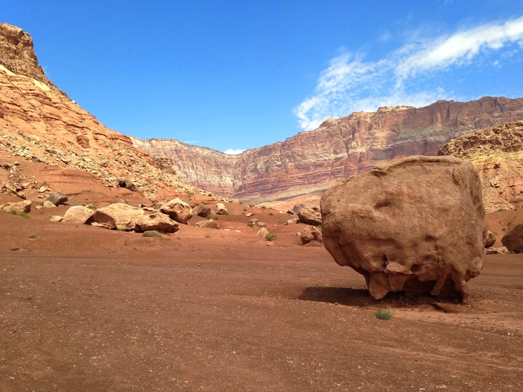
 Well, my husband and companion wanderer is one of those MacGyver types. After getting a jump (yep we always carry cables) from fellow travelers, he confronted things under the hood and found that the....okay you guys, this is in layman's terms, this is a gal who does not know cars writing this!...... He found that the connection to the battery post was loose and would not close all the way. I was dismayed as I thought we'd need to high tail it back home and give up this last leg of the trip out to the Vermilion Cliffs and Marble Canyon. In fact I suggested we do so and not risk the car going dead again.